The State Library of NSW will be hosting a one day workshop for those interested in using maps for historical research on Wednesday 25 July. Maps can hold a wealth of information to enrich you history research or project. If you are a map novice, come along to hear all about what they can show you, how to find them at the Library and be inspired by some of our favourites.
The program includes the following sessions:
Why use maps?
Maps are a rich source of information and can be invaluable to your research. This session will go over the main benefits of using maps and provide an overview of the Library’s maps collection.
Subdivision plans of Sydney
Mostly from the 1860s to the 1930s, these posters were produced by real estate agents to promote newly created estates and subdivisions. They illustrate the urban development of Sydney and New South Wales, as large estates were divided up and transformed into suburbs and towns. This session will include a case study of a Sydney suburb.
Find your suburb and street
In this hands-on session, we’ll show you how to search the Library’s collection of maps to uncover valuable historical details about your suburb and street.
County, town & parish maps
County, town and parish maps are visual indexes to the administration of land in New South Wales. This session will provide you with tips on how to use these maps to track down the history of a parcel of land.
Early maps of Sydney
If you are interested in general maps of Sydney this session will give you some tips on finding some fascinating maps and will use examples from the collection to show the gradual development of Sydney from 1788.
Early maps of New South Wales
If you are interested in maps of New South Wales this session will give you some tips on finding some fascinating maps and will use examples from the collection to show the exploration and mapping of New South Wales from 1788.
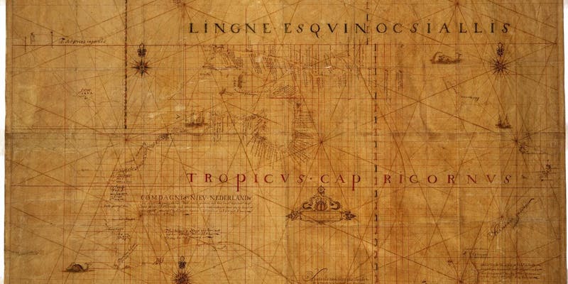
Mapping Australia’s place in the World
Using examples from the collection this session will provide a high level but fascinating history of the mapping of Australia from the 16th to the 21st century.
Some sessions run concurrently. Please check the website for full details. There will be a lunch break between 12.30-1.30. Please bring your own lunch, or there are a number of food outlets nearby, including Café Trim at the Library.
When: 25 July, 10.00-3.30pm
Where: Macquarie Street building foyer, Macquarie St, Sydney NSW 2000
Cost: $50 + booking fee
Contact: learning.library@sl.nsw.gov.au or (02) 9273 1778