The Australian Centre for Public History is hosting a series of monthly seminars on researching history where you can learn about research projects that are being shaped by digital methodologies, and discuss the implications of this for how we understand, construct and communicate about the past. Seminars will be held on Thursday evenings, 5.30-7pm and are a part of ACPH’s History Central Seminar series.
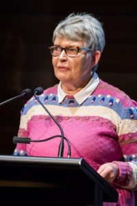
The next seminar on Thursday 14th March 2019 will feature winner of the 2018 Annual History Citation, Professor Lyndall Ryan of the University of Newcastle, presenting “The Intimacy of Digital Mapping: The Frontier Massacres Mapping Project and the Connection to Regional Australia”
Abstract
In July 2017, the release of stage 1 of the digital map of 172 frontier massacre sites in Eastern Australia to 1872 generated an enormous response from regional Australia. A year later, when Stage 2 of the map was launched with more than 250 sites in Central and Eastern Australia to 1930, more than 500 people from regional Australia had accessed the contact page on the map to provide information about new and /or existing sites and make suggestions for improvement. It was then that the research team realised that they were the custodians of a national project in which regional Australians expected to make a significant contribution.
How has the research team grappled with this unexpected situation?
To address the question, the presentation will first reprise the project origins to show how it influenced the project design and methodology used in Stage 1. Then in response to the issues raised by regional Australians it will discuss the changes that the team included in Stage 2 and outline the plans for Stage 3 due for release in late 2019.
The presentation finds that regional Australians know more about frontier massacres than their urban cousins. They are also anxious to ensure that the disparate forms of evidence for each site is made as accessible in digital form. To this end, evidence that is available in digital form, such as newspapers on trove, has been incorporated into the map.
The publicly available map is available at https://c21ch.newcastle.edu.au/colonialmassacres
The presentation concludes that digital maps can not only help to make the past visible, they can reconnect in intimate ways regional and urban Australians in their understanding of the past.
You can find out more here.
When: Thursday 14th March 2019, 5.30pm to 7.30pm
Where: University of Technology Sydney – Building 10, Level 14, Room 201
Contact & Registration: public.history@uts.edu.au